
Berlin in constant change
Berlin is above all one thing: a city of contrasts. The elegant boulevards, trendy neighborhoods, village structures, large housing estates, battered facades and royal palaces together create the image of the metropolis.
“There is a reason why Berlin is preferable to other cities: because it is constantly changing.” Bertolt Brecht, 1928
With a population of around 3.6 million, the capital not only looks back on its own visible transformation, it has also repeatedly played an important role as a scene of German history over the centuries. The different eras have left their mark on the city’s image. The buildings bear witness both to the representational needs of the Prussians and the Empire, and to the awakening of the twenties. Beyond built testimonies of National Socialism, traces of the Second World War and the division of Berlin can be found. Buildings always symbolized the respective political conditions of the time and lead to the heterogeneous architecture of the city today. Today, Berlin is considered a world city of culture, politics, media and science. Its architecture, cultural diversity and nightlife are known worldwide.
Architecture and History
Germany’s largest city is constantly reinventing itself for a reason. In the course of its history, Berlin grew from 0.2 to 4.5 million inhabitants between 1820 and 1940. New neighborhoods emerged and incorporations led to the decentralized organization with many smaller city centers that still prevails today.
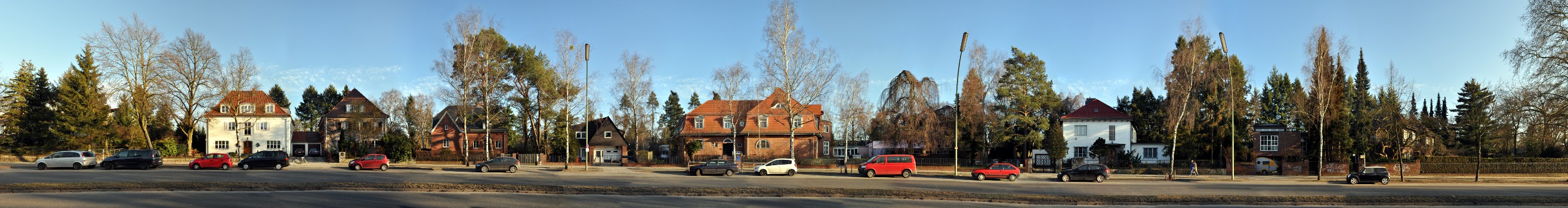
Furthermore, excellent examples of social housing can be found from the New Building period of the ambitious 1920s, which are now on the UNESCO World Heritage List. Many of them are from the hand of architect Bruno Taut, as is the panoramic example of Buschallee in Hohenschönhausen.
During the Second World War, Berlin was heavily destroyed. The topic of reconstruction was therefore discussed on the basis of many important buildings, including the Berlin Cathedral. This was rebuilt and partially reconstructed in the following decades. Over the 40 years of German division, different reconstruction measures were developed by the competing systems. The GDR built its so-called palaces for workers along Karl-Marx-Allee in the 1950s, followed later by cheaper and faster to realize prefabricated buildings (Plattenbau), for example along Landsberger Allee. In the western part, architects presented their forward-looking designs at the IBA in 1957. It was within this framework that the new Hansa Quarter was created, because in the FRG, too, the main concern at that time was the rapid provision of living space.
The fall of the Wall in 1989 reunited not only a country, but also Berlin. The city is no longer conceivable without the places of remembrance along Bernauer Strasse, Check-Point Charlie and Mauerpark. Complex construction and building histories such as that of the Friedrichstadt Passagen show in detail what division and reunification brought about architecturally.
Again and again, Berlin discusses how to deal with monuments, heritage and, in this context, with preservation or demolition. And here, too, the city once again demonstrates its penchant for contrast: while the Palace of the Republic was demolished, the Berlin Palace is currently being rebuilt with a reconstructed baroque façade. The Europa-City around Berlin’s main train station, with its typically contemporary office and residential buildings, has not even been completed yet and is criticized in the demolition atlas by journalists, art historians and architects. Berlin continues to change and at least remains true to itself in this.
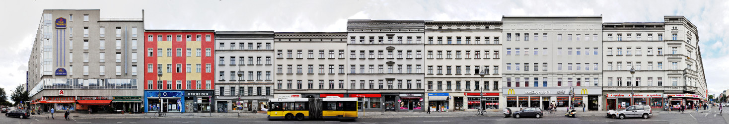
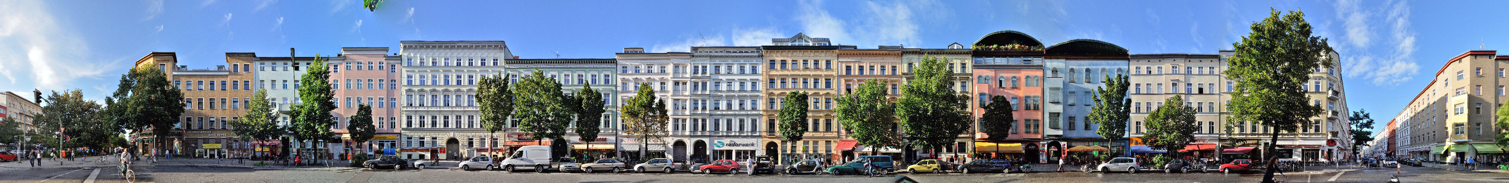
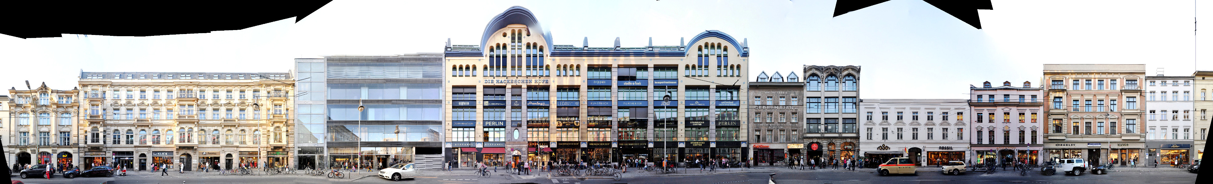
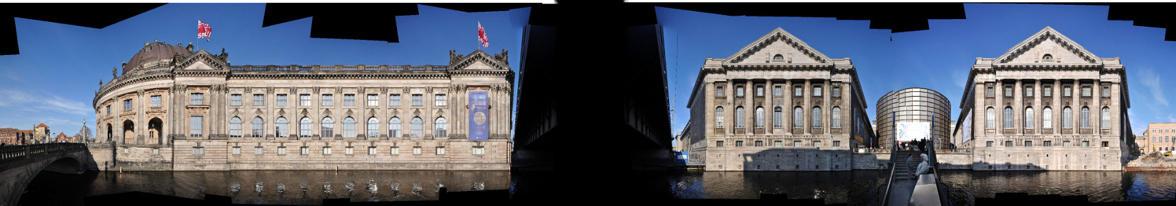
Our Streetline City Documentation of Berlin
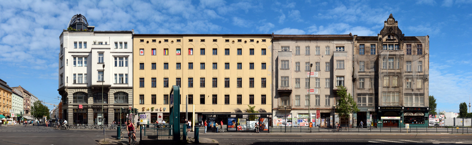
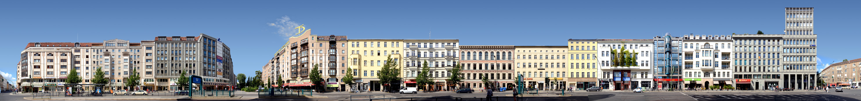
Our photographic documentation of Berlins streets now includes most inner city districts adding up to ca. 100 documented street views, of which around 25 have been finnished and published (see below). An overview of all documented streets in Berlin gives our worldmap. This includes Plattenbau areas from East Berlin as well as historic street blocks from Berlin Mitte or views of the grand boulevards of West Berlin. Also still existing parts of the Berlin Wall (East Side Gallery, Bernauer Straße) are included as well as the street blocks incorporating sacred buildings, typical for Berlin, for example the Yorckstrasse in Kreuzberg or the Oranienburger Strasse with the New Synagogue. However, this diversity of photographed streets cannot cover one problem typical for photographing Berlin: the large number of alleys lined with trees in Berlin’s streets makes it hard to realize Streetline Panoramas, if not impossible, in a lot of places.
A list of finnished Berlin Streetlines, click them to see them in detail:
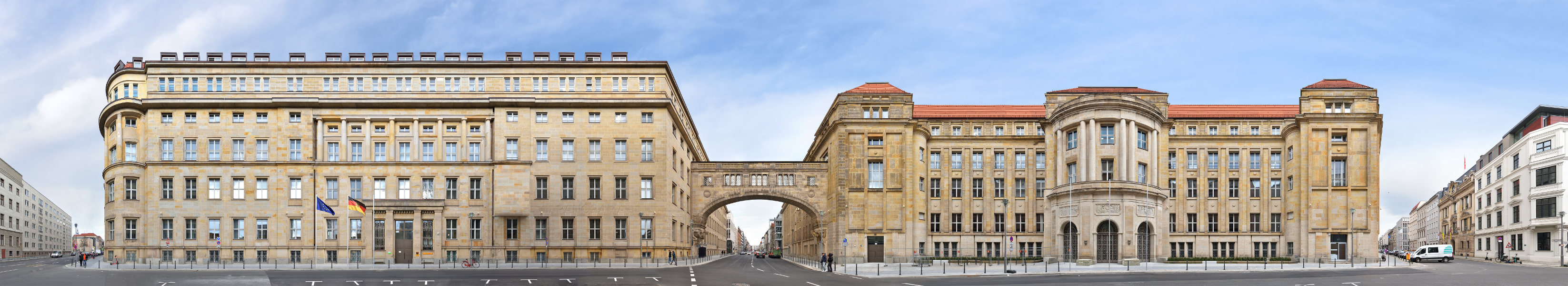
BMG | BMFSFJ | Federal Ministries Mauerstraße · Berlin · Germany

Poststadion · Berlin · Germany
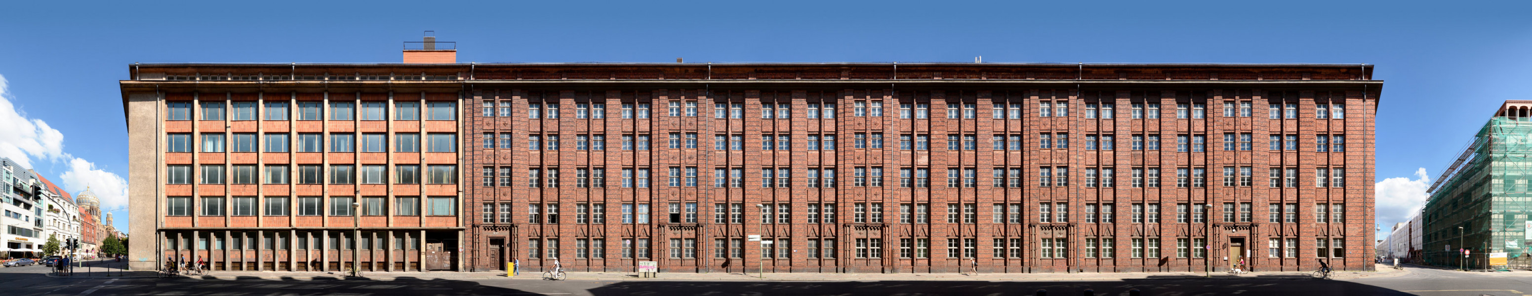
Fernsprechamt | Tucholskystrasse · Berlin · Germany
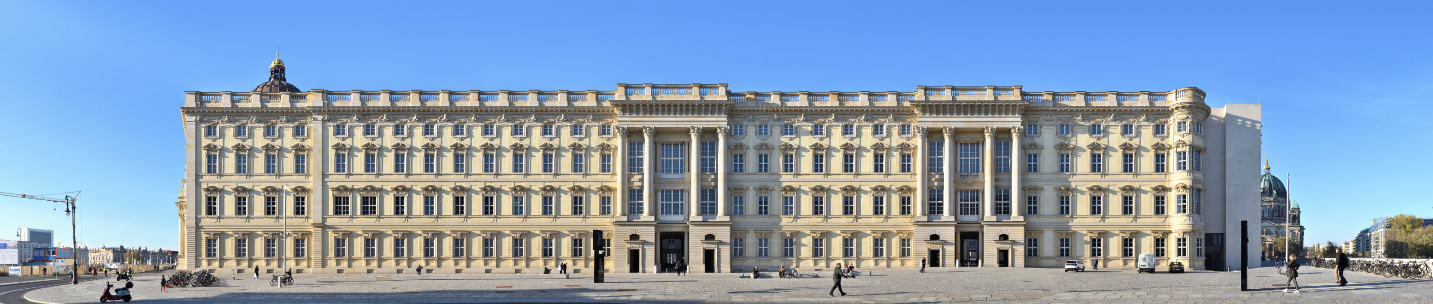
Berlin Palace | southern front · Berlin · Germany
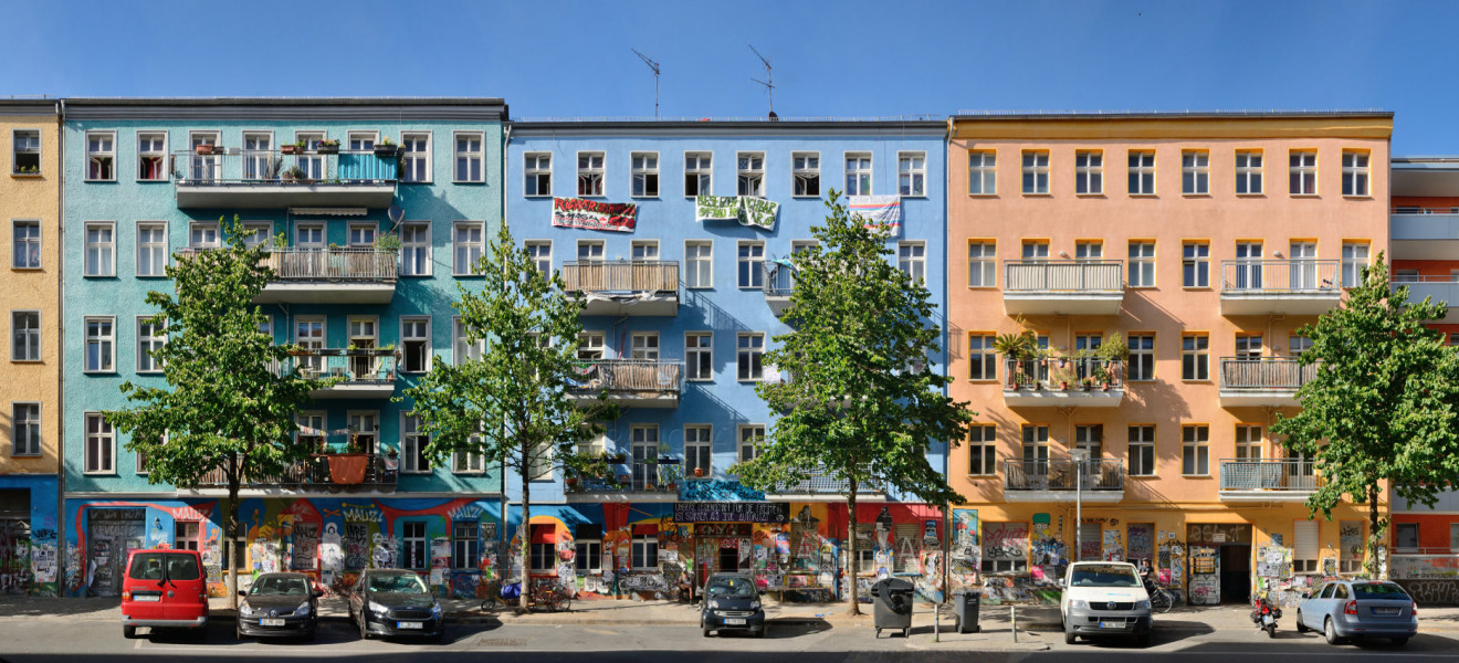
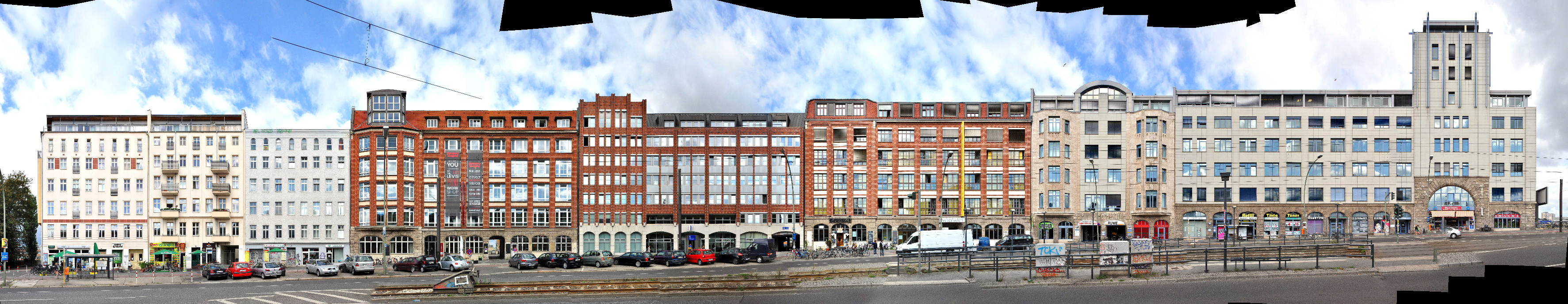
Rigaer Strasse · Berlin · Germany
Muehlenstrasse | street art · Berlin · Germany
Friedrichstrasse | Oranienburger Tor · Berlin · Germany

Friedrichstrasse | Friedrichstadt Passagen · Berlin · Germany
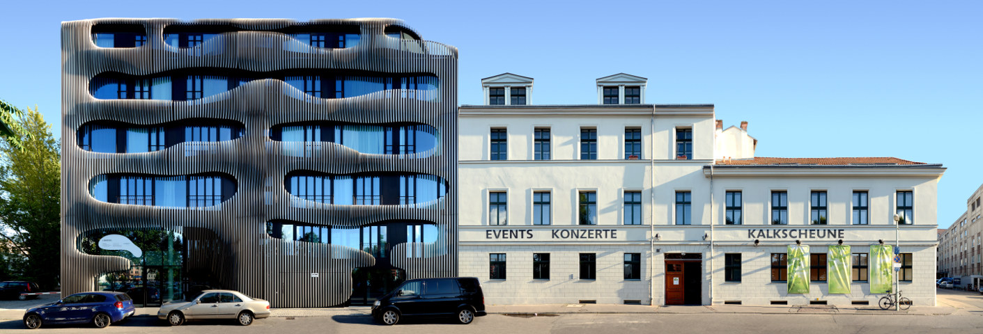
Johannisstrasse / Kalkscheune / JOH3 · Berlin · Germany
Friedrichstrasse · Berlin · Germany
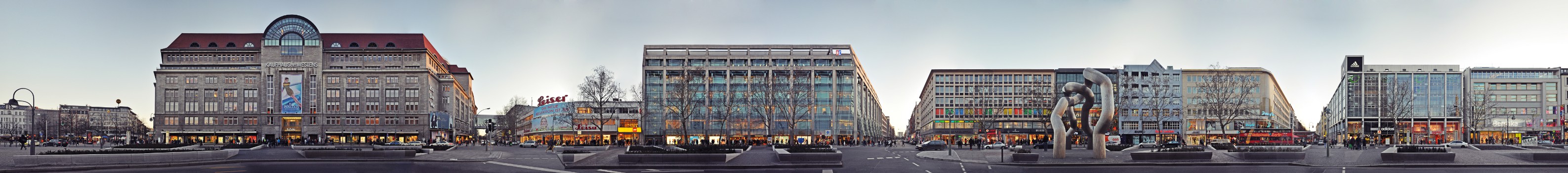
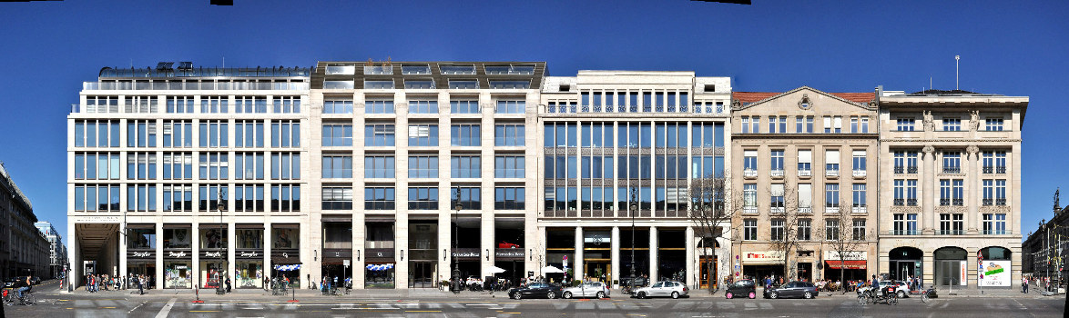
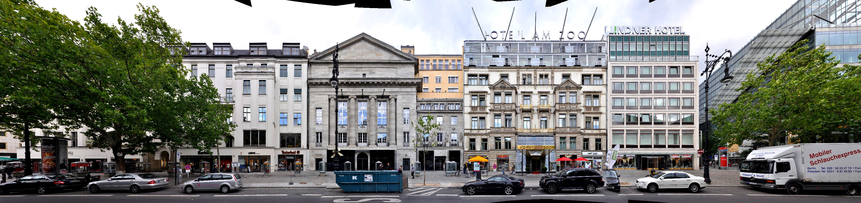
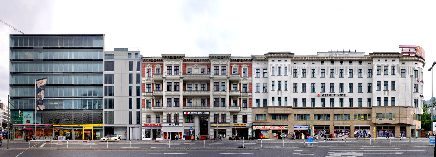
Tauentzienstrasse / KaDeWe · Berlin · Germany
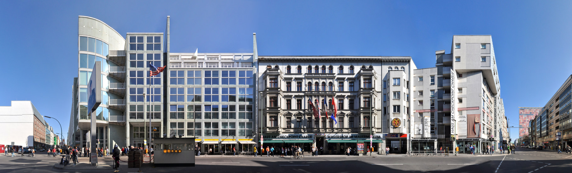
Checkpoint Charlie - Friedrichstrasse · Berlin · Germany

Berlin Wall - East Side Gallery 1 · Berlin · Germany
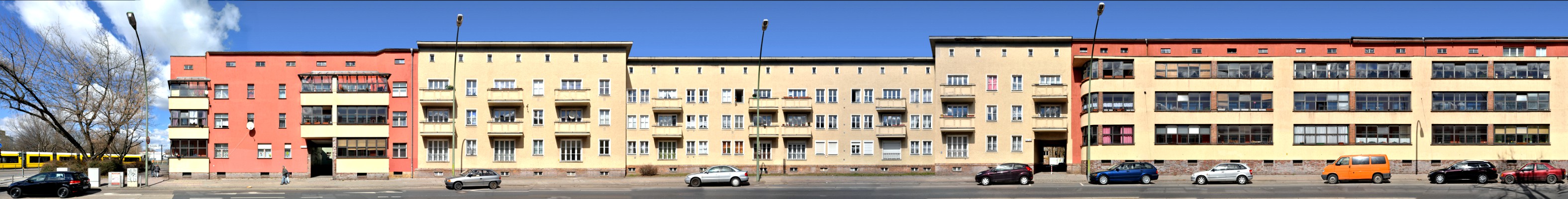
Buschallee / Hohenschoenhausen · Berlin · Germany
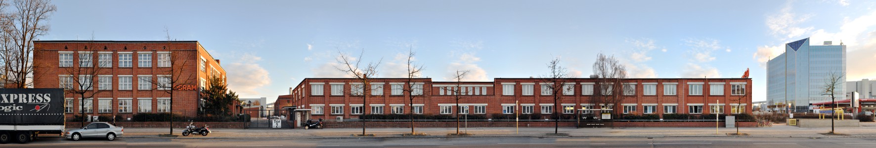
Nonnendammallee - OSRAM · Berlin · Germany
Argentinische Allee / Zehlendorf · Berlin · Germany
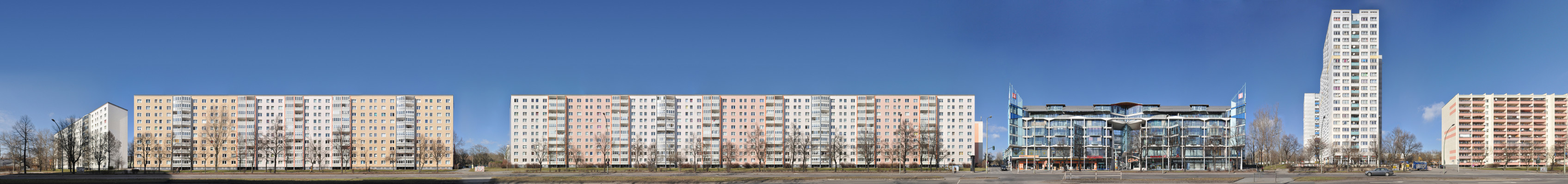
Landsberger Allee / Castello · Berlin · Germany
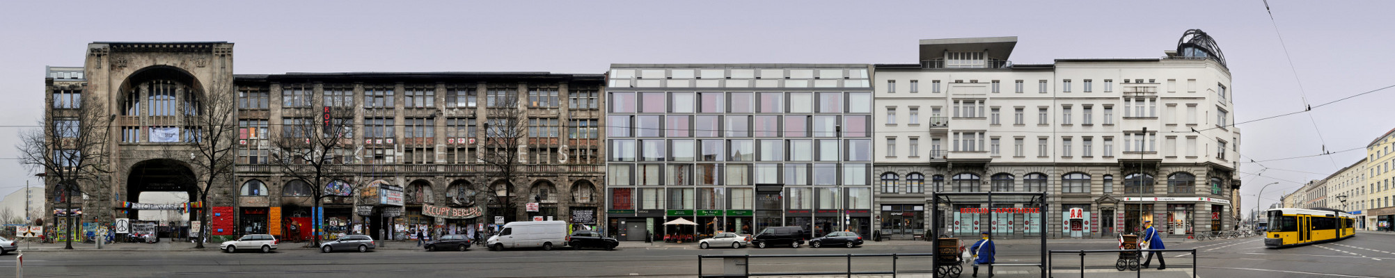
Tacheles Art House / Oranienburger Strasse · Berlin · Germany

New Synagogue | Oranienburger Strasse · Berlin · Germany
Schiffbauerdamm · Berlin · Germany
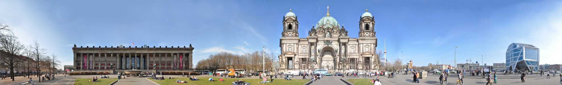
Lustgarten with Berlin Cathedral and Altes Museum · Berlin · Germany
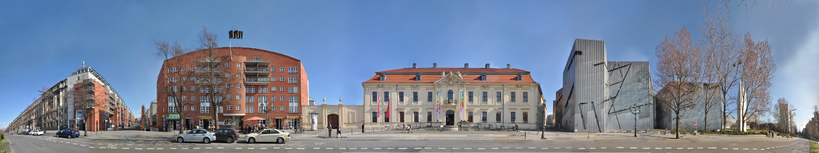
Jewish Museum - Lindenstrasse · Berlin · Germany

Berlin Wall - Bernauer Strasse · Berlin · Germany
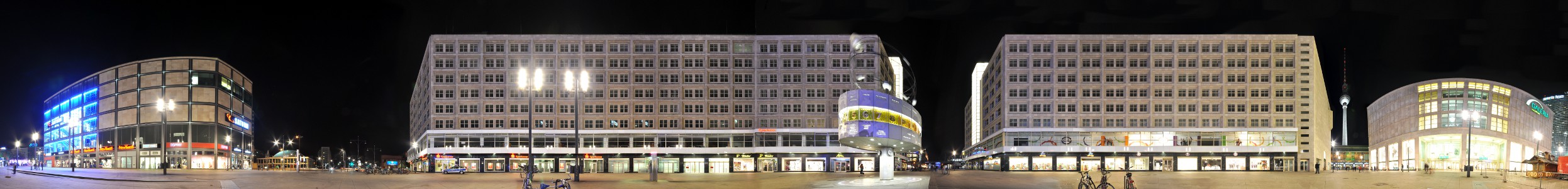
Alexanderplatz and Weltzeituhr · Berlin · Germany
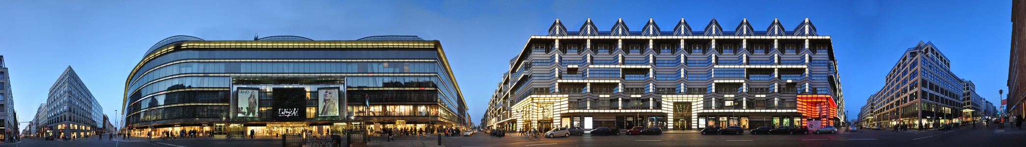
Friedrichstrasse - Quartier 206/207 · Berlin · Germany
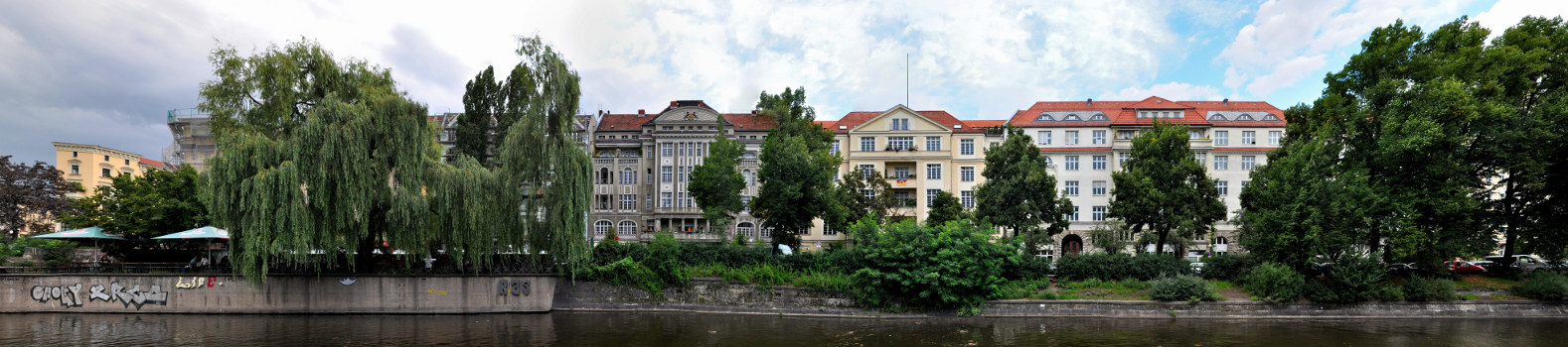
Paul-Lincke-Ufer · Berlin · Germany
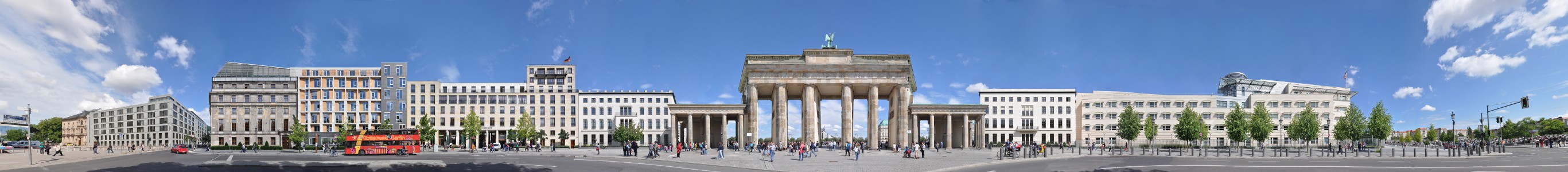
Brandenburg Gate - Ebertstrasse · Berlin · Germany
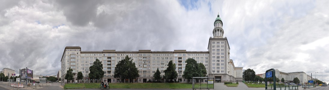
Karl-Marx-Allee · Berlin · Germany
Already work in progress panoramas are listed here below:
Friedrichshain | Warschauer Strasse
Kreuzberg | Herrmannplatz
Kreuzberg | Bergmannstraße
Mitte | Hackesche Hoefe / Rosenthaler Strasse / Oranienburger Strasse
Mitte | Bodemuseum / Pergamonmuseum / Kupfergraben
Mitte | Unter den Linden
Charlottenburg | Kurfuerstendamm
Charlottenburg | Joachimsthaler Strasse
Spandau | Nonnendammalle / Osram nachts
