Edinburgh is best known for its built heritage which earned the city UNESCO world heritage status in 1995. This applies to the two most central areas of the city, the Old Town with Edinburgh Castle and the Royal Mile as well as the planned Georgian New Town north of it. The old town is the area running up castle hill from the Holyrood Palace at its foot to Edinburgh Castle on top. This complete route is now the famous Royal Mile (actually four consecutive streets), with numerous very small alleys, so called Closes, on either side of it. Being built solely on the stretching hill, the city soon became crowded and so some of the old stone buildings became very early high rises with up to ten and even more storeys.
The New Town was planned in the 18th century to find a solution for the over-crowded city. A 27 year old architect, James Craig, won the competition for the New Town and designed an ordered grid with three main streets running parallel to the Old Town, several crossroads and two main squares. The New Town is very consistent with its Georgian style buildings, only the southern main street, Princes Street, has changed its look radically, becoming Edinburgh’s main shopping street with several newer buildings.
During our visit to the scottish capital we documented numerous streets within the Old Town and New Town as well as some streetscapes from the West End and Leith areas. Here you’ll find the completed and published streetlines:
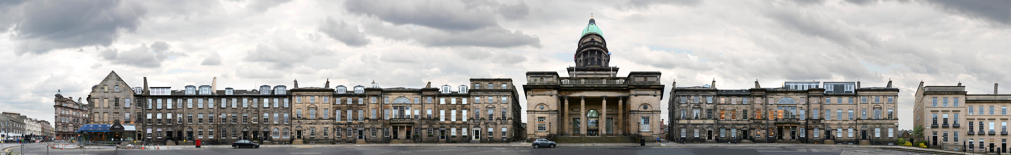
Charlotte Square | West Register House · Edinburgh · United Kingdom
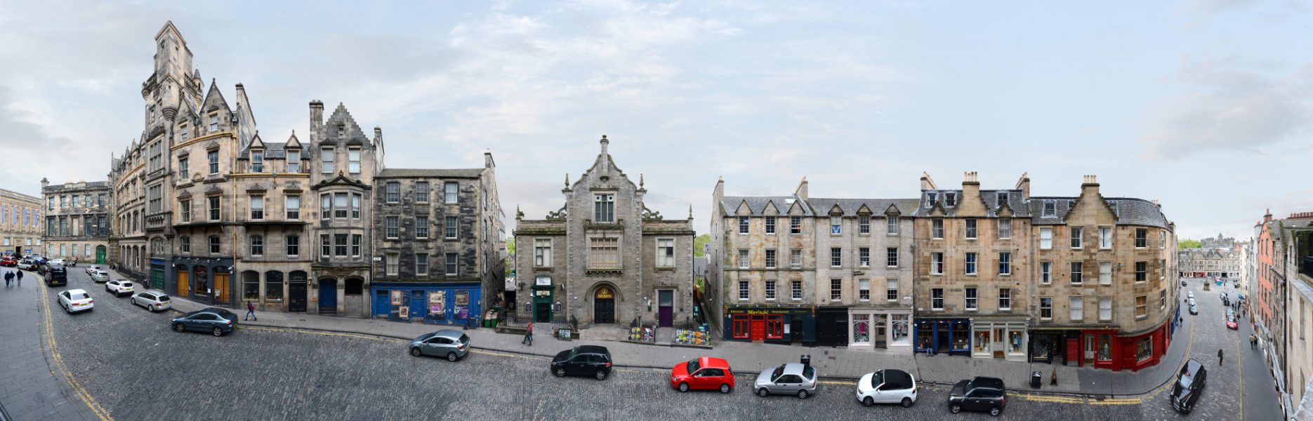
Victoria Street · Edinburgh · United Kingdom
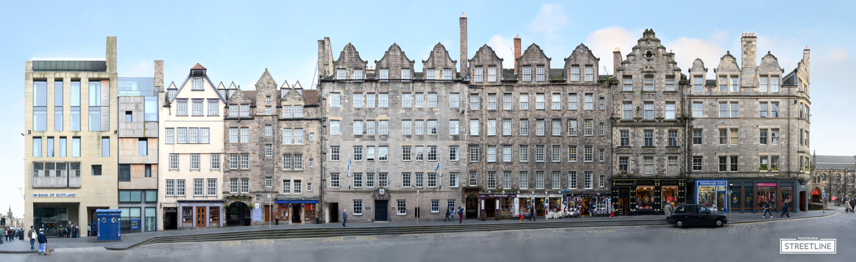
Royal Mile | Lawnmarket · Edinburgh · United Kingdom
Our archive includes the complete Royal Mile on both sides, several more streets in the Old Town, in the New Town sections of Princes Street and George Street, as well as Charlotte Square and a few other street views. In the West End we photographed the train station and Haymarket Terrace, furthermore a part of the Leith Walk and the Shore in Leith. Buildings we included are for example the National Library of Scotland, the Carlton, the Balmoral, Jenners, Donaldson’s College, the West Register House and the Scottish National Portrait Gallery.
Below you will find a number of previews of further streetview panoramas from Edinburgh. These are still work in progress and will be finnished over time or if we get requests for a specific view.
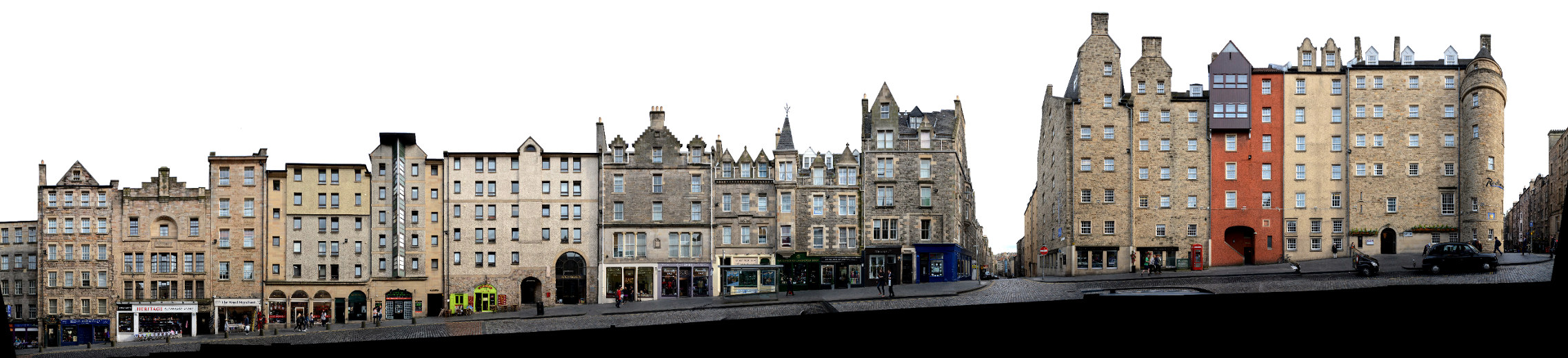
High Street | Royal Mile
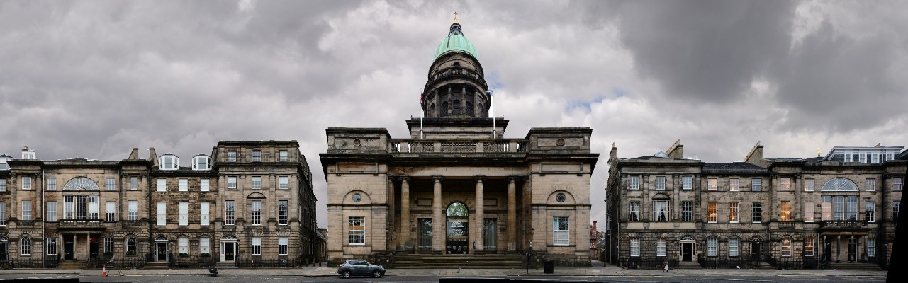
Charlotte Square | West Register House
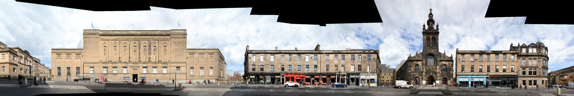
George IV Bridge | National Library of Scotland
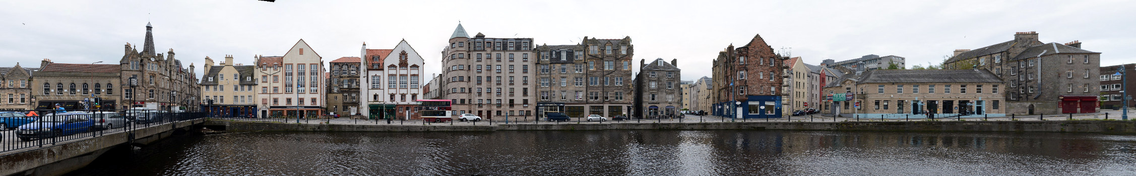
Water of Leith | Shore
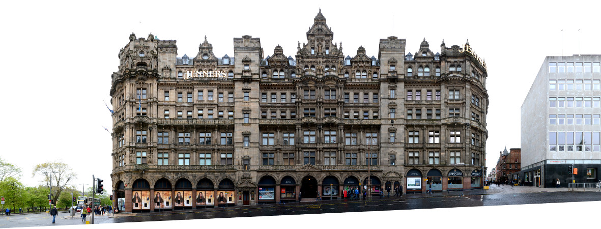
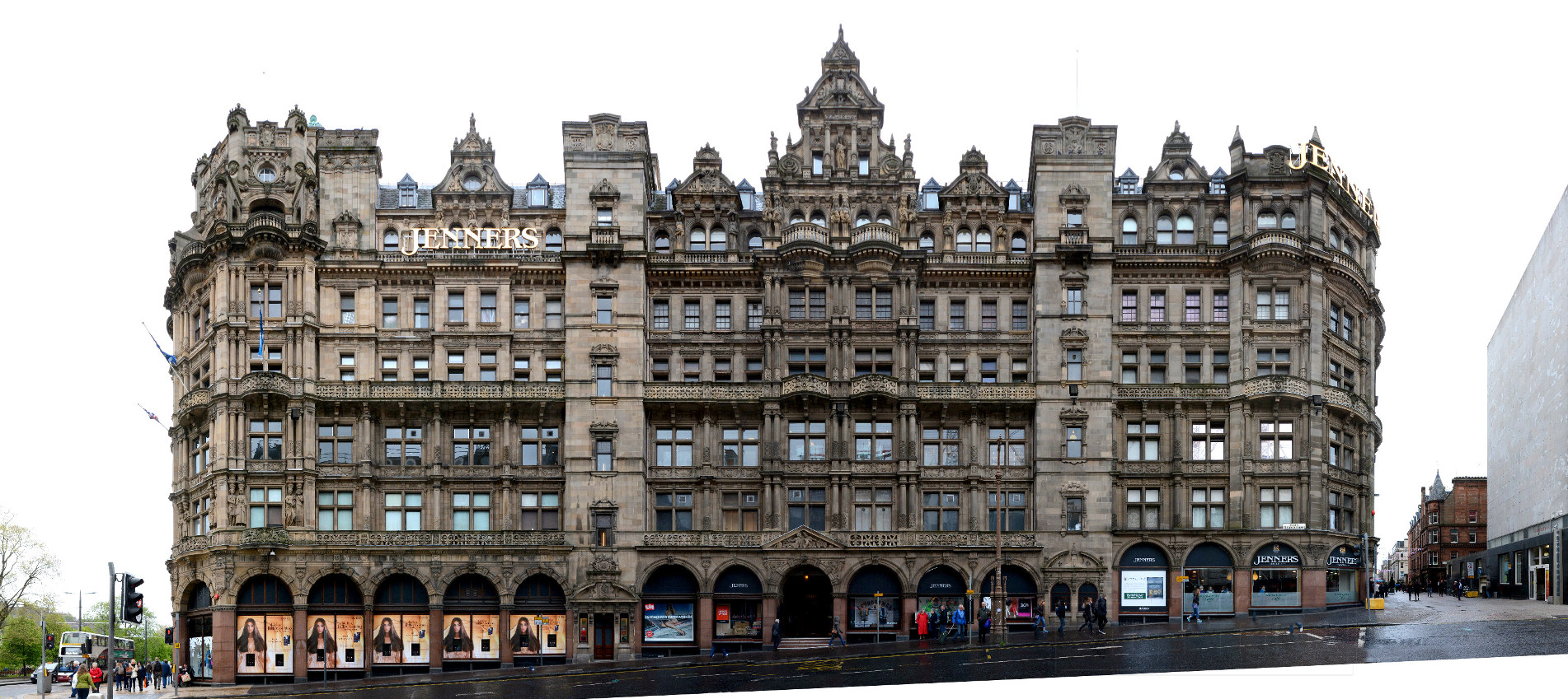
Jenners | South St. David Street
To find out which other streets and cities we documented in Scotland you can check our worldmap. For historic Edinburgh Photos visit Lost Edinburgh | For more info visit Edinburgh World Heritage | For more Edinburgh Architecture news visit www.edinburgharchitecture.co.uk